The Concrete Structure Investigations team came across a couple of interesting articles on the use of GPR technology for archeological […]
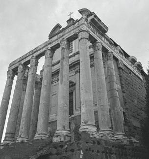
The Concrete Structure Investigations team came across a couple of interesting articles on the use of GPR technology for archeological purposes. The article discusses the first high-resolution ground-penetrating radar survey of an ancient Roman town (Falerii Novi, in Lazio, Italy). Through the use of this technology, archaeologists uncovered previously unrecorded public buildings; such as a temple, market building, bath complex, and the ancient water pipes – pretty incredible.
Ground-penetrating radar also known as GPR is a reliable method that provides high-resolution 3D images of buried structures. GPR is considered one of the more complicated of near-surface geophysical techniques, but also one of the more precise, because of its ability to map buried archaeological features in three-dimensions. This method relies on the reflection of electromagnetic waves. Given the challenges of locating ancient towns and cities, not to mention the enormous cost and time of digging for evidence; we thought the deep penetration of these GPR technologies was the perfect solution. GPR technologies can be used with more complicated arrangements. Using GPR technology archaeologists were able to map a complete Roman city for the first time, revealing highly detailed images that they say could revolutionise our understanding of how such sites worked. To read the full article click here.
Digging out around the ancient towns would be the ultimate aim; so that the archaeologists can really look closely at the artefacts, town planning, social organisation, human remains and ‘stories’ etc. We think they used the best device to speed up the process of discovery as GPR can also identify significant sites to proceed with digging. GPR can also guide progress so that nothing precious is damaged in the process. No doubt there are many other reasons for archaeologists to have a good idea of what is underground before decisions are made and money invested. GPR maps are great as they can be used to display a large amount of information from limited excavations to produce a great deal of knowledge from a very large area.
A local example can be found in ‘The Wellington Town Hall Architectural History’. On the 18th June 1901, the “Duke of Cornwall and York lays a three-ton granite foundation stone with a time capsule inside”. Now wouldn’t this be exciting to locate! The team at CSI believes so! Read more about the Town Hall timeline here. GPR is a relatively new geophysical technique, within the last decade we have seen major advances, there is an overall sense of the technology reaching a new level of maturity. There is no doubt that we will continue to see some amazing discoveries in the future because of this technology.
At CSI we often use Ground Penetrating Radar as part of our ‘scanning suite’. If you’d like to talk to New Zealand’s scanning experts and find out how GPR technology can help with your next project then please contact us today. Drop us a line directly via email or phone 0800 33 7767.

Leave a Reply
You must be logged in to post a comment.